Geolocate

Laurel topographic map

Click on the map to display elevation.

About this map

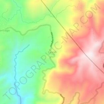
Name: Laurel topographic map, elevation, terrain.

Location: Laurel, Santa Maria, Laguna, Calabarzon, Philippines (14.53314 121.44227 14.57314 121.48227)

Average elevation: 1,447 ft

Minimum elevation: 312 ft

Maximum elevation: 2,631 ft

Gear up for your next adventure:

⛑️Personal Locator Beacon - Safety beacon for emergencies
🧭Orienteering Set - Complete compass and map reading kit
🧼Biodegradable Camping Soap - Eco‑friendly soap for outdoor hygiene
📡GPS Antenna Upgrade - Enhance GPS reception in remote terrain
🦟Ultrasonic Repellers - Create a bug-free zone at your camp or rest stop

As an Amazon Associate, this site earns from qualifying purchases at no extra cost to you.