
Thank you for supporting this site ❤️
Make a donation
Make a donation
Gear up for your next adventure:
As an Amazon Associate, this site earns from qualifying purchases at no extra cost to you.
Neelkanth topographic map
Click on the map to display elevation.
Thank you for supporting this site ❤️
Make a donation
Make a donation
Gear up for your next adventure:
As an Amazon Associate, this site earns from qualifying purchases at no extra cost to you.
About this map
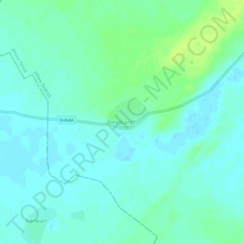
Name: Neelkanth topographic map, elevation, terrain.
Location: Neelkanth, Ahore Tehsil, Jalore District, Rajasthan, India (25.63299 72.69194 25.67299 72.73194)
Average elevation: 479 ft
Minimum elevation: 463 ft
Maximum elevation: 509 ft
Thank you for supporting this site ❤️
Make a donation
Make a donation
Gear up for your next adventure:
As an Amazon Associate, this site earns from qualifying purchases at no extra cost to you.