Geolocate

Sarin topographic map

Click on the map to display elevation.

About this map

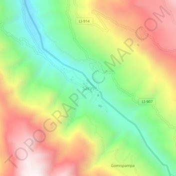
Name: Sarin topographic map, elevation, terrain.

Location: Sarin, Sarín, Province of Sánchez Carrión, La Libertad, Peru (-7.93132 -77.92577 -7.89132 -77.88577)

Average elevation: 10,318 ft

Minimum elevation: 8,655 ft

Maximum elevation: 12,293 ft

Gear up for your next adventure:

🗺️NatGeo Topo Maps - High-quality waterproof printed topographic maps of US Parks
🧭Outdoor Navigation Book - Learn advanced navigation skills
👓Polarized Sunglasses - Outdoor sunglasses for glare reduction
🪶Wildlife Field Guides - Learn animal tracking and species ID
🦶Hiking Gaiters - Keep debris and water out of your boots

As an Amazon Associate, this site earns from qualifying purchases at no extra cost to you.