
Thank you for supporting this site ❤️
Make a donation
Make a donation
Gear up for your next adventure:
As an Amazon Associate, this site earns from qualifying purchases at no extra cost to you.
Sumbersari topographic map
Click on the map to display elevation.
Thank you for supporting this site ❤️
Make a donation
Make a donation
Gear up for your next adventure:
As an Amazon Associate, this site earns from qualifying purchases at no extra cost to you.
About this map
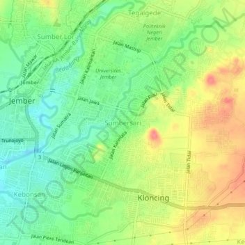
Name: Sumbersari topographic map, elevation, terrain.
Location: Sumbersari, Jember, East Java, Java, 68121, Indonesia (-8.19256 113.69881 -8.15256 113.73881)
Average elevation: 341 ft
Minimum elevation: 240 ft
Maximum elevation: 466 ft
Thank you for supporting this site ❤️
Make a donation
Make a donation
Gear up for your next adventure:
As an Amazon Associate, this site earns from qualifying purchases at no extra cost to you.