
Hucknall topographic map
Click on the map to display elevation.
Hucknall
Hucknall Airfield, built in 1916, became RAF Hucknall. From 1927, Rolls-Royce began using the airfield for flight tests. During World War II, the aerodrome at Hucknall launched the first flight of a P-51 Mustang fitted with a Rolls-Royce Merlin Engine. The Merlin, replacing the earlier Allison V-1710 engine, allowed the Mustang air frame to reach its full potential and achieve spectacular high-altitude performance.
About this map
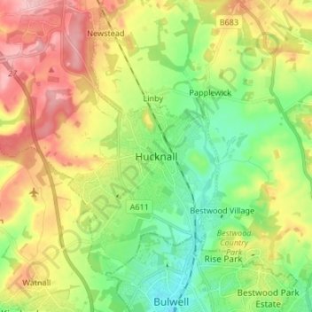
Name: Hucknall topographic map, elevation, terrain.
Average elevation: 341 ft
Minimum elevation: 144 ft
Maximum elevation: 610 ft