
Ouled Ali topographic map
Interactive map
Click on the map to display elevation.
About this map
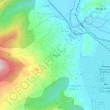
Name: Ouled Ali topographic map, elevation, terrain.
Location: Ouled Ali, El Milia, Daïra El Milia, Jijel, 18300, Algérie (36.73474 6.20933 36.77474 6.24933)
Average elevation: 423 ft
Minimum elevation: 49 ft
Maximum elevation: 1,496 ft
Other topographic maps
Click on a map to view its topography, its elevation and its terrain.
Barrage Boussiaba
Algérie > Jijel > Daïra El Milia > El Milia > Ouled Arbi
Barrage Boussiaba, Ouled Arbi, El Milia, Daïra El Milia, Jijel, Algérie
Average elevation: 472 ft
Oued Zehour
Algérie > Jijel > Daïra El Milia > El Milia
Oued Zehour, El Milia, Daïra El Milia, Jijel, Algérie
Average elevation: 640 ft