
Make a donation
Gear up for your next adventure:
As an Amazon Associate, this site earns from qualifying purchases at no extra cost to you.
Sint-Joris topographic map
Click on the map to display elevation.
Make a donation
Gear up for your next adventure:
As an Amazon Associate, this site earns from qualifying purchases at no extra cost to you.
About this map
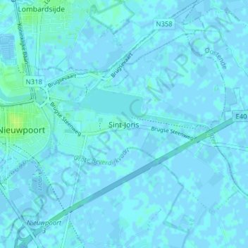
Name: Sint-Joris topographic map, elevation, terrain.
Average elevation: 3 ft
Minimum elevation: -10 ft
Maximum elevation: 33 ft
Make a donation
Gear up for your next adventure:
As an Amazon Associate, this site earns from qualifying purchases at no extra cost to you.
Other topographic maps
Click on a map to view its topography, its elevation and its terrain.
Sint-Joris
België > West-Vlaanderen > Veurne > Nieuwpoort
Het zuidelijke deel van Sint-Joris met de dorpskern ligt ingeklemd tussen de IJzer, hier verbreed tot het Spaarbekken, en de Noordvaart. Deze komen samen in de Ganzepoot, een bijzonder sluizencomplex ten westen van Sint-Joris. Sint-Joris ligt op ongeveer 3 meter hoogte boven TAW.
Average elevation: 3 ft
Ramskapelle
België > West-Vlaanderen > Veurne > Nieuwpoort
Ramskapelle ligt in het West-Vlaamse polderland op een hoogte van ongeveer 2,5 meter. De belangrijkste waterlopen zijn de Noordvaart en de Ramskapelleleed. In het noordwesten bevindt zich de A18.
Average elevation: 3 ft
Make a donation
Gear up for your next adventure:
As an Amazon Associate, this site earns from qualifying purchases at no extra cost to you.