
Greenbrier River topographic map
Interactive map
Click on the map to display elevation.
About this map
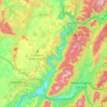
Name: Greenbrier River topographic map, elevation, terrain.
Average elevation: 2,290 ft
Minimum elevation: 1,654 ft
Maximum elevation: 3,307 ft
Other topographic maps
Click on a map to view its topography, its elevation and its terrain.
Newhall
VS > West Virginia > Newhall
Newhall, McDowell County, West Virginia, 24866, VS
Average elevation: 2,044 ft