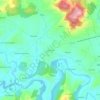
Lugo topographic map
Click on the map to display elevation.
About this map

Name: Lugo topographic map, elevation, terrain.
Location: Lugo, Llanera, Asturias, España (43.41193 -5.84869 43.46361 -5.78965)
Average elevation: 614 ft
Minimum elevation: 338 ft
Maximum elevation: 1,407 ft
Other topographic maps
Click on a map to view its topography, its elevation and its terrain.


Prubia
España > Asturias > Llanera > Santolaya / Soto de Llanera > Prubia de Abajo
Average elevation: 650 ft