Geolocate

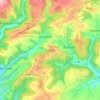
Kyllburg topographic map

Click on the map to display elevation.

About this map

Name: Kyllburg topographic map, elevation, terrain.

Location: Kyllburg, Bitburger Land, Eifelkreis Bitburg-Prüm, Rijnland-Palts, 54657, Duitsland (50.02664 6.58018 50.05597 6.61793)

Average elevation: 1,220 ft

Minimum elevation: 843 ft

Maximum elevation: 1,539 ft

Other topographic maps

Click on a map to view its topography, its elevation and its terrain.

Buscht

Duitsland > Rijnland-Palts > Eifelkreis Bitburg-Prüm

Average elevation: 1,234 ft

Gear up for your next adventure:

🛡️Insect Repellent - Protection against bugs during outdoor activities
🥤Water Filter Bottle - All‑in‑one filter bottle for safe hydration
💧Water Purification System - Clean water on the trail with reliable purifiers
☀️Outdoor Sunscreen - High protection sunscreen for outdoor activities
🎒Trail Energy Bars - High‑calorie bars for hiking energy

As an Amazon Associate, this site earns from qualifying purchases at no extra cost to you.