Geolocate

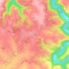
Le Bez topographic map

Click on the map to display elevation.

About this map

Name: Le Bez topographic map, elevation, terrain.

Location: Le Bez, Castres, Tarn, Occitania, Metropolitan France, 81260, France (43.57194 2.39838 43.66517 2.51388)

Average elevation: 2,051 ft

Minimum elevation: 1,129 ft

Maximum elevation: 2,904 ft

Other topographic maps

Click on a map to view its topography, its elevation and its terrain.
Le Bez

France > Occitania > Tarn > Mirandol-Bourgnounac

Average elevation: 1,224 ft

La Mothe

France > Occitania > Tarn > Castelnau-de-Lévis

Average elevation: 666 ft

Gear up for your next adventure:

🌡️Portable Weather Meter - Track weather conditions on the trail
🪶Thermal Camp Blanket - Extra warmth for cold nights
🌎3D Topographic Globes - Raised relief globes for a tactile understanding of geography
🏕️Family Camping Gear - Essentials for group camping trips
🔭Compact Binoculars - HD vision for scouting terrain and identifying distant landmarks

As an Amazon Associate, this site earns from qualifying purchases at no extra cost to you.