Geolocate

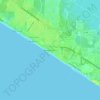
Laguna Beach topographic map

Click on the map to display elevation.

About this map

Name: Laguna Beach topographic map, elevation, terrain.

Location: Laguna Beach, Whisper Dunes, Panama City Beach, Bay County, Florida, 32413, United States (30.25585 -85.94122 30.25740 -85.93693)

Average elevation: 30 ft

Minimum elevation: -3 ft

Maximum elevation: 52 ft

Bay County trails, hiking, mountain biking, running and outdoor activities

Other topographic maps

Click on a map to view its topography, its elevation and its terrain.
Gear up for your next adventure:

🧤Hiking Gloves - Protective gloves for rugged trails
🪶Fire Starter Kit - Reliable fire starter for survival and camping
🎁Geography Themed Gifts - Unique gift ideas for map lovers and geography enthusiasts
🕶️GPS Smartphone Mount - Secure mount for phone navigation
🧢Outdoor Hiking Hat - Sun protection hat for outdoor explorers

As an Amazon Associate, this site earns from qualifying purchases at no extra cost to you.