
Aypate topographic map
Click on the map to display elevation.
About this map
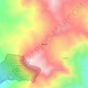
Name: Aypate topographic map, elevation, terrain.
Location: Aypate, Distrito de Ayabaca, Ayabaca, Piura, Perú (-4.71976 -79.59300 -4.67976 -79.55300)
Average elevation: 8,314 ft
Minimum elevation: 6,745 ft
Maximum elevation: 9,446 ft
Other topographic maps
Click on a map to view its topography, its elevation and its terrain.
Área de Conservación Privada Lagunas y Páramos de Andinos de San José de Tapal
Perú > Piura > Distrito de Ayabaca
Average elevation: 11,001 ft