
Thalberg topographic map
Interactive map
Click on the map to display elevation.
About this map
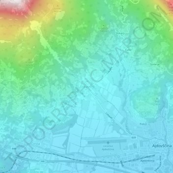
Name: Thalberg topographic map, elevation, terrain.
Location: Thalberg, Haidenschaft, 5270, Slowenien (45.88212 13.85978 45.92212 13.89978)
Average elevation: 856 ft
Minimum elevation: 318 ft
Maximum elevation: 3,402 ft
Other topographic maps
Click on a map to view its topography, its elevation and its terrain.
Leitenberg
Leitenberg, Haidenschaft, 5270, Slowenien
Average elevation: 584 ft