
Thank you for supporting this site ❤️
Make a donation
Make a donation
Gear up for your next adventure:
As an Amazon Associate, this site earns from qualifying purchases at no extra cost to you.
Keboireng topographic map
Click on the map to display elevation.
Thank you for supporting this site ❤️
Make a donation
Make a donation
Gear up for your next adventure:
As an Amazon Associate, this site earns from qualifying purchases at no extra cost to you.
About this map
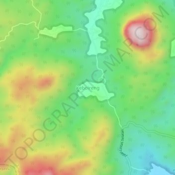
Name: Keboireng topographic map, elevation, terrain.
Location: Keboireng, Tulungagung, East Java, Java, Indonesia (-8.25545 111.73852 -8.21545 111.77852)
Average elevation: 817 ft
Minimum elevation: 20 ft
Maximum elevation: 2,070 ft
Thank you for supporting this site ❤️
Make a donation
Make a donation
Gear up for your next adventure:
As an Amazon Associate, this site earns from qualifying purchases at no extra cost to you.