Geolocate

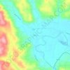
Onalaska topographic map

Click on the map to display elevation.

About this map

Name: Onalaska topographic map, elevation, terrain.

Location: Onalaska, Lewis County, Washington, 98570, United States (46.56826 -122.73787 46.58892 -122.68281)

Average elevation: 568 ft

Minimum elevation: 436 ft

Maximum elevation: 817 ft

Lewis County trails, hiking, mountain biking, running and outdoor activities

Other topographic maps

Click on a map to view its topography, its elevation and its terrain.
Randle

United States > Washington > Lewis County

Average elevation: 1,240 ft

Cinebar

United States > Washington > Lewis County

Average elevation: 1,010 ft

The Rockies

United States > Washington > Lewis County

Average elevation: 3,320 ft

Silver Falls

United States > Washington > Lewis County

Average elevation: 2,779 ft

Angry Mountain

United States > Washington > Lewis County

Average elevation: 4,596 ft

Onalaska

United States > Washington > Lewis County

Average elevation: 558 ft

Packwood

United States > Washington > Lewis County

Average elevation: 1,243 ft

Adna

United States > Washington > Lewis County

Average elevation: 269 ft

Mayfield

United States > Washington > Lewis County

Average elevation: 732 ft

Bunker

United States > Washington > Lewis County

Average elevation: 331 ft

Ceres

United States > Washington > Lewis County

Average elevation: 404 ft

Glenoma

United States > Washington > Lewis County

Average elevation: 1,161 ft

Randle

United States > Washington > Lewis County

Average elevation: 1,240 ft

Gear up for your next adventure:

🔥Camping Stove - Portable stove for camping and backcountry cooking
🖼️Topo Map Wall Art - Decorative topographic prints of famous peaks and regions
🔦LED Headlamp - Bright and durable LED headlamp for night navigation
🧺Microfiber Travel Towels - Compact and fast-drying towels for trail use
🧣Hiking Neck Gaiter - Multi‑use neck protection for outdoor weather

As an Amazon Associate, this site earns from qualifying purchases at no extra cost to you.