
Make a donation
Gear up for your next adventure:
As an Amazon Associate, this site earns from qualifying purchases at no extra cost to you.
Shepherd topographic map
Click on the map to display elevation.
Make a donation
Gear up for your next adventure:
As an Amazon Associate, this site earns from qualifying purchases at no extra cost to you.
About this map
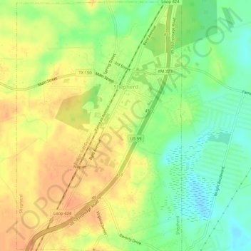
Name: Shepherd topographic map, elevation, terrain.
Location: Shepherd, San Jacinto County, Texas, 77371, United States (30.46883 -95.01910 30.51328 -94.98512)
Average elevation: 148 ft
Minimum elevation: 72 ft
Maximum elevation: 213 ft
San Jacinto County trails, hiking, mountain biking, running and outdoor activities
Make a donation
Gear up for your next adventure:
As an Amazon Associate, this site earns from qualifying purchases at no extra cost to you.
Other topographic maps
Click on a map to view its topography, its elevation and its terrain.
Pointblank
United States > Texas > San Jacinto County > Point Blank > Pointblank
Average elevation: 174 ft