
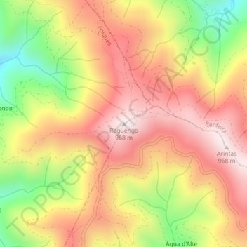
Reguengo topographic map
Interactive map
Click on the map to display elevation.
About this map
Name: Reguengo topographic map, elevation, terrain.
Average elevation: 2,372 ft
Minimum elevation: 1,289 ft
Maximum elevation: 3,159 ft
Other topographic maps
Click on a map to view its topography, its elevation and its terrain.
Cepos
Portugal > Centro > Cepos e Teixeira
Cepos, Cepos e Teixeira, Arganil, Coimbra, Pinhal Interior Norte, Centro, Portugal
Average elevation: 1,906 ft
Relvas
Portugal > Centro > Cepos e Teixeira > Relvas
Relvas, Teixeira, Cepos e Teixeira, Arganil, Coimbra, Pinhal Interior Norte, Centro, 3320-076, Portugal
Average elevation: 2,149 ft
Catraia
Portugal > Centro > Cepos e Teixeira
Catraia, Cepos e Teixeira, Arganil, Coimbra, Pinhal Interior Norte, Centro, 3320-076, Portugal
Average elevation: 2,270 ft