
Thank you for supporting this site ❤️
Make a donation
Make a donation
Gear up for your next adventure:
As an Amazon Associate, this site earns from qualifying purchases at no extra cost to you.
Dadholi topographic map
Click on the map to display elevation.
Thank you for supporting this site ❤️
Make a donation
Make a donation
Gear up for your next adventure:
As an Amazon Associate, this site earns from qualifying purchases at no extra cost to you.
About this map
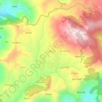
Name: Dadholi topographic map, elevation, terrain.
Location: Dadholi, Dwarahat, Almora District, Uttarakhand, 263654, India (29.73892 79.40748 29.77892 79.44748)
Average elevation: 4,754 ft
Minimum elevation: 3,842 ft
Maximum elevation: 5,545 ft
Thank you for supporting this site ❤️
Make a donation
Make a donation
Gear up for your next adventure:
As an Amazon Associate, this site earns from qualifying purchases at no extra cost to you.