
Rio Ilave topographic map
Interactive map
Click on the map to display elevation.
About this map
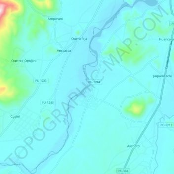
Name: Rio Ilave topographic map, elevation, terrain.
Location: Rio Ilave, Ácora, Puno, Perú (-16.21027 -69.72464 -16.11255 -69.66276)
Average elevation: 12,720 ft
Minimum elevation: 12,549 ft
Maximum elevation: 14,393 ft
Other topographic maps
Click on a map to view its topography, its elevation and its terrain.