Geolocate

Misano topographic map

Click on the map to display elevation.

About this map

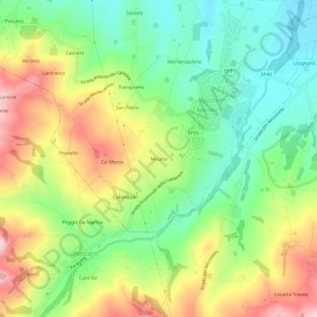
Name: Misano topographic map, elevation, terrain.

Location: Misano, Agazzano, Piacenza, Emilia-Romagna, Italy (44.91818 9.48911 44.95818 9.52911)

Average elevation: 787 ft

Minimum elevation: 440 ft

Maximum elevation: 1,280 ft

Gear up for your next adventure:

🔭Telescopic Hiking Pole - Adjustable pole for hiking stability
📚USA Hiking Guide Books - Top trail guides and map books
🔥Camping Stove - Portable stove for camping and backcountry cooking
📱Heavy-Duty Phone Cases - Drop-proof and waterproof protection for outdoor navigation
🍳Camping Cook Set - Complete cookware for outdoor meals

As an Amazon Associate, this site earns from qualifying purchases at no extra cost to you.