
Thank you for supporting this site ❤️
Make a donation
Make a donation
Gear up for your next adventure:
As an Amazon Associate, this site earns from qualifying purchases at no extra cost to you.
Sorba topographic map
Click on the map to display elevation.
Thank you for supporting this site ❤️
Make a donation
Make a donation
Gear up for your next adventure:
As an Amazon Associate, this site earns from qualifying purchases at no extra cost to you.
About this map
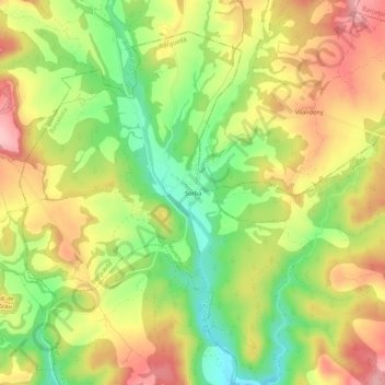
Name: Sorba topographic map, elevation, terrain.
Location: Sorba, Montmajor, Berguedà, Barcelona, Cataluña, España (41.94777 1.64849 41.98777 1.68849)
Average elevation: 1,788 ft
Minimum elevation: 1,519 ft
Maximum elevation: 2,047 ft
Thank you for supporting this site ❤️
Make a donation
Make a donation
Gear up for your next adventure:
As an Amazon Associate, this site earns from qualifying purchases at no extra cost to you.