Geolocate

Chhatri topographic map

Click on the map to display elevation.

About this map

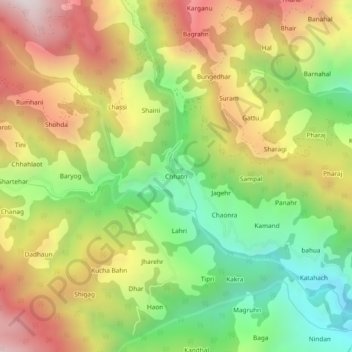
Name: Chhatri topographic map, elevation, terrain.

Location: Chhatri, Thunag, Mandi District, Himachal Pradesh, India (31.44646 77.26940 31.48646 77.30940)

Average elevation: 6,821 ft

Minimum elevation: 4,925 ft

Maximum elevation: 8,976 ft

Gear up for your next adventure:

📶Vehicle Signal Boosters - Improve reception in rural areas while driving to trailheads
🧭Pro Hiking Compasses - High-accuracy liquid-filled compasses for topographic orientation
🧣Hiking Neck Gaiter - Multi‑use neck protection for outdoor weather
🚑Emergency Bivvies - Heat-reflective sleeping bags for survival situations
🧦Merino Wool Socks - Moisture-wicking, blister-preventing socks for long treks

As an Amazon Associate, this site earns from qualifying purchases at no extra cost to you.