
Bukit Raja topographic map
Interactive map
Click on the map to display elevation.
About this map
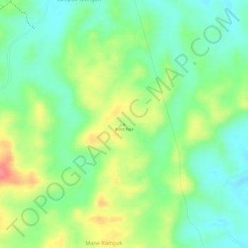
Name: Bukit Raja topographic map, elevation, terrain.
Location: Bukit Raja, Julok, Aceh Timur, Aceh, Indonesia (5.00625 97.59405 5.00635 97.59415)
Average elevation: 164 ft
Minimum elevation: 52 ft
Maximum elevation: 318 ft
Other topographic maps
Click on a map to view its topography, its elevation and its terrain.
Taman Nasional Gunung Leuser
Indonesia > Aceh > Rambung Jaya
Taman Nasional Gunung Leuser, Rambung Jaya, Darul Hasanah, Aceh Tenggara, Aceh, Indonesia
Average elevation: 1,512 ft
Gunung Leuser
Gunung Leuser, Kuta Panjang, Gayo Lues, Aceh, Indonesia
Average elevation: 8,386 ft