
Thank you for supporting this site ❤️
Make a donation
Make a donation
Gear up for your next adventure:
As an Amazon Associate, this site earns from qualifying purchases at no extra cost to you.
Asker topographic map
Click on the map to display elevation.
Thank you for supporting this site ❤️
Make a donation
Make a donation
Gear up for your next adventure:
As an Amazon Associate, this site earns from qualifying purchases at no extra cost to you.
About this map
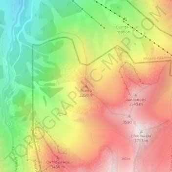
Name: Asker topographic map, elevation, terrain.
Location: Asker, Qarasay District, Almaty Region, Kazakhstan (43.10880 77.09146 43.10890 77.09156)
Average elevation: 9,800 ft
Minimum elevation: 7,356 ft
Maximum elevation: 12,126 ft
Thank you for supporting this site ❤️
Make a donation
Make a donation
Gear up for your next adventure:
As an Amazon Associate, this site earns from qualifying purchases at no extra cost to you.