
Thank you for supporting this site ❤️
Make a donation
Make a donation
Gear up for your next adventure:
As an Amazon Associate, this site earns from qualifying purchases at no extra cost to you.
Cachora topographic map
Click on the map to display elevation.
Thank you for supporting this site ❤️
Make a donation
Make a donation
Gear up for your next adventure:
As an Amazon Associate, this site earns from qualifying purchases at no extra cost to you.
About this map
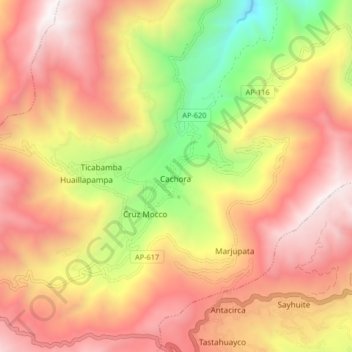
Name: Cachora topographic map, elevation, terrain.
Location: Cachora, San Pedro de Cachora, Abancay, Apurímac, Peru (-13.53277 -72.83304 -13.49277 -72.79304)
Average elevation: 10,390 ft
Minimum elevation: 8,645 ft
Maximum elevation: 12,959 ft
Thank you for supporting this site ❤️
Make a donation
Make a donation
Gear up for your next adventure:
As an Amazon Associate, this site earns from qualifying purchases at no extra cost to you.