
Thank you for supporting this site ❤️
Make a donation
Make a donation
Gear up for your next adventure:
As an Amazon Associate, this site earns from qualifying purchases at no extra cost to you.
Ithalar topographic map
Click on the map to display elevation.
Thank you for supporting this site ❤️
Make a donation
Make a donation
Gear up for your next adventure:
As an Amazon Associate, this site earns from qualifying purchases at no extra cost to you.
About this map
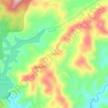
Name: Ithalar topographic map, elevation, terrain.
Location: Ithalar, Kundah, Nilgiris, Tamil Nadu, 643004, India (11.32281 76.61802 11.36281 76.65802)
Average elevation: 6,759 ft
Minimum elevation: 6,296 ft
Maximum elevation: 7,356 ft
Thank you for supporting this site ❤️
Make a donation
Make a donation
Gear up for your next adventure:
As an Amazon Associate, this site earns from qualifying purchases at no extra cost to you.