Geolocate

Jidi topographic map

Click on the map to display elevation.

About this map

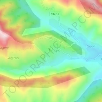
Name: Jidi topographic map, elevation, terrain.

Location: Jidi, Lankaran District, Lankaran-Astara, Azerbaijan (38.84709 48.59616 38.85545 48.61191)

Average elevation: 814 ft

Minimum elevation: 328 ft

Maximum elevation: 1,578 ft

Gear up for your next adventure:

🥇GPS Hiking Watch - Multi‑sport GPS watch with navigation and trail tracking
🥾Hiking Shoes - Durable and comfortable shoes for trail hiking
🥘Titanium Cookware - Durable, featherlight pots and pans for backpacking
🪶Camping Sleeping Pad - Comfortable sleeping pad for backpacking
🔋Rechargeable Batteries - Power up your outdoor devices

As an Amazon Associate, this site earns from qualifying purchases at no extra cost to you.