
Make a donation
Gear up for your next adventure:
As an Amazon Associate, this site earns from qualifying purchases at no extra cost to you.
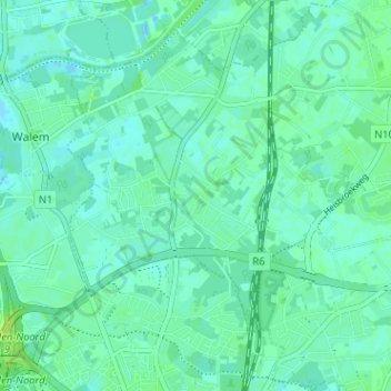
Elzestraat topographic map
Click on the map to display elevation.
Make a donation
Gear up for your next adventure:
As an Amazon Associate, this site earns from qualifying purchases at no extra cost to you.
Elzestraat
Elzestraat ligt in het westelijk deel van Sint-Katelijne-Waver, rond de Sint-Augustinuskerk. Het gehucht omvat onder meer de Clemenceaustraat, Liersesteenweg, Hogevelden, Walemstraat, Kuikenstraat, Groenstraat en Midzelen. In 1836 werd het gehucht doorgesneden door de spoorlijn Mechelen-Antwerpen (spoorlijn 25). Rond de eeuwwisseling werd de dubbelsporige spoorlijn 27B aangelegd dwars door de dorpskern. Deze was afgetakt van spoorlijn 25 ten zuiden van het gehucht ter hoogte van de Vrouwvliet en liep verder tot Antwerpen-Zuid. Dit spoor werd in 1970 opgebroken maar restanten van deze lijn zijn nog zichtbaar.
Make a donation
Gear up for your next adventure:
As an Amazon Associate, this site earns from qualifying purchases at no extra cost to you.
About this map
Name: Elzestraat topographic map, elevation, terrain.
Average elevation: 13 ft
Minimum elevation: -7 ft
Maximum elevation: 39 ft
Make a donation
Gear up for your next adventure:
As an Amazon Associate, this site earns from qualifying purchases at no extra cost to you.