
Thank you for supporting this site ❤️
Make a donation
Make a donation
Gear up for your next adventure:
As an Amazon Associate, this site earns from qualifying purchases at no extra cost to you.
Los Barrios topographic map
Click on the map to display elevation.
Thank you for supporting this site ❤️
Make a donation
Make a donation
Gear up for your next adventure:
As an Amazon Associate, this site earns from qualifying purchases at no extra cost to you.
About this map
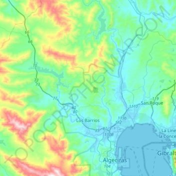
Name: Los Barrios topographic map, elevation, terrain.
Location: Los Barrios, Campo de Gibraltar, Cádiz, Andalusia, Spain (36.10935 -5.70739 36.35050 -5.41402)
Average elevation: 538 ft
Minimum elevation: -13 ft
Maximum elevation: 2,569 ft
Thank you for supporting this site ❤️
Make a donation
Make a donation
Gear up for your next adventure:
As an Amazon Associate, this site earns from qualifying purchases at no extra cost to you.
Other topographic maps
Click on a map to view its topography, its elevation and its terrain.
Santa Margarita
Spain > Andalusia > Campo de Gibraltar > La Línea de la Concepción
Average elevation: 207 ft