
Thank you for supporting this site ❤️
Make a donation
Make a donation
Gear up for your next adventure:
As an Amazon Associate, this site earns from qualifying purchases at no extra cost to you.
Ihuayllo topographic map
Click on the map to display elevation.
Thank you for supporting this site ❤️
Make a donation
Make a donation
Gear up for your next adventure:
As an Amazon Associate, this site earns from qualifying purchases at no extra cost to you.
About this map
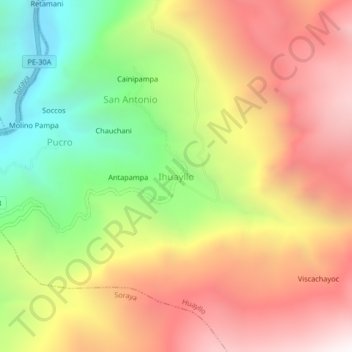
Name: Ihuayllo topographic map, elevation, terrain.
Location: Ihuayllo, Huayllo, Aymaraes, Apurímac, Perú (-14.15343 -73.28794 -14.11343 -73.24794)
Average elevation: 11,306 ft
Minimum elevation: 8,192 ft
Maximum elevation: 14,190 ft
Thank you for supporting this site ❤️
Make a donation
Make a donation
Gear up for your next adventure:
As an Amazon Associate, this site earns from qualifying purchases at no extra cost to you.