
Vahibé topographic map
Interactive map
Click on the map to display elevation.
About this map
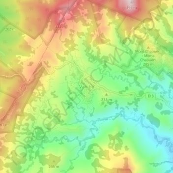
Name: Vahibé topographic map, elevation, terrain.
Location: Vahibé, Mamoudzou, Mayotte, 97605, France (-12.81090 45.15684 -12.77090 45.19684)
Average elevation: 722 ft
Minimum elevation: 52 ft
Maximum elevation: 1,545 ft
Other topographic maps
Click on a map to view its topography, its elevation and its terrain.
Tsoundzou 1
Tsoundzou 1, Mamoudzou, Mayotte, 97605, France
Average elevation: 171 ft
Parc de la Pointe Mahabou
Parc de la Pointe Mahabou, Doujani, Mamoudzou, Mayotte, 97600, France
Average elevation: 20 ft