
Bản Dơ Tơ Bo topographic map
Interactive map
Click on the map to display elevation.
About this map
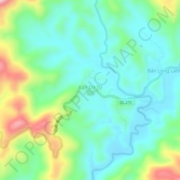
Name: Bản Dơ Tơ Bo topographic map, elevation, terrain.
Location: Bản Dơ Tơ Bo, Lạc Dương District, Lâm Đồng Province, Vietnam (12.11919 108.61356 12.15919 108.65356)
Average elevation: 4,941 ft
Minimum elevation: 4,606 ft
Maximum elevation: 5,814 ft
Other topographic maps
Click on a map to view its topography, its elevation and its terrain.
Mont Lang Biang belvédère
Vietnam > Lâm Đồng Province > Lạc Dương District > Lạc Dương
Mont Lang Biang belvédère, Lạc Dương, Lạc Dương District, Lâm Đồng Province, Vietnam
Average elevation: 5,315 ft