
Boulder beach topographic map
Interactive map
Click on the map to display elevation.
About this map
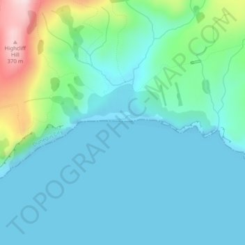
Name: Boulder beach topographic map, elevation, terrain.
Average elevation: 236 ft
Minimum elevation: 0 ft
Maximum elevation: 1,234 ft
Other topographic maps
Click on a map to view its topography, its elevation and its terrain.
Mount Thompson
Mount Thompson, Dunedin, Dunedin City, Otago, New Zealand
Average elevation: 1,657 ft
Mount Misery
Mount Misery, Dunedin, Dunedin City, Otago, New Zealand
Average elevation: 1,493 ft