
Mount Misery topographic map
Interactive map
Click on the map to display elevation.
About this map
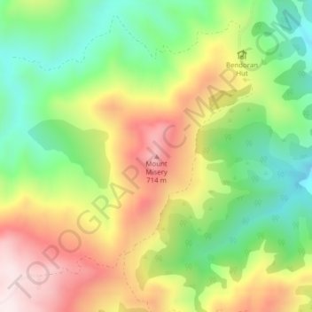
Name: Mount Misery topographic map, elevation, terrain.
Location: Mount Misery, Dunedin, Dunedin City, Otago, New Zealand (-45.67502 170.44507 -45.67492 170.44517)
Average elevation: 1,493 ft
Minimum elevation: 692 ft
Maximum elevation: 2,474 ft
Other topographic maps
Click on a map to view its topography, its elevation and its terrain.
Boulder beach
Boulder beach, Buskin Road Track, Macandrew Bay, Dunedin, Dunedin City, Otago, 9014, New Zealand
Average elevation: 236 ft
Mount Thompson
Mount Thompson, Dunedin, Dunedin City, Otago, New Zealand
Average elevation: 1,657 ft