
Thank you for supporting this site ❤️
Make a donation
Make a donation
Gear up for your next adventure:
As an Amazon Associate, this site earns from qualifying purchases at no extra cost to you.
Rumuruti topographic map
Click on the map to display elevation.
Thank you for supporting this site ❤️
Make a donation
Make a donation
Gear up for your next adventure:
As an Amazon Associate, this site earns from qualifying purchases at no extra cost to you.
About this map
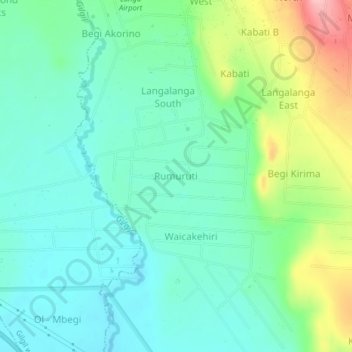
Name: Rumuruti topographic map, elevation, terrain.
Location: Rumuruti, Morendat ward, Gilgil, Nakuru, Rift Valley, Kenya (-0.54790 36.34314 -0.50790 36.38314)
Average elevation: 6,516 ft
Minimum elevation: 6,378 ft
Maximum elevation: 6,877 ft
Thank you for supporting this site ❤️
Make a donation
Make a donation
Gear up for your next adventure:
As an Amazon Associate, this site earns from qualifying purchases at no extra cost to you.