
Thank you for supporting this site ❤️
Make a donation
Make a donation
Gear up for your next adventure:
As an Amazon Associate, this site earns from qualifying purchases at no extra cost to you.
Colcha topographic map
Click on the map to display elevation.
Thank you for supporting this site ❤️
Make a donation
Make a donation
Gear up for your next adventure:
As an Amazon Associate, this site earns from qualifying purchases at no extra cost to you.
About this map
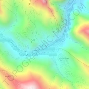
Name: Colcha topographic map, elevation, terrain.
Location: Colcha, Municipio Arque, Arque, Cochabamba, Bolivia (-17.85305 -66.42710 -17.85062 -66.42475)
Average elevation: 9,905 ft
Minimum elevation: 9,042 ft
Maximum elevation: 11,407 ft
Thank you for supporting this site ❤️
Make a donation
Make a donation
Gear up for your next adventure:
As an Amazon Associate, this site earns from qualifying purchases at no extra cost to you.