Geolocate

Templin topographic map

Click on the map to display elevation.

About this map

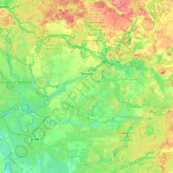
Name: Templin topographic map, elevation, terrain.

Location: Templin, Uckermark, Brandenburg, 17268, Germany (52.98698 13.32229 53.21704 13.67169)

Average elevation: 210 ft

Minimum elevation: 121 ft

Maximum elevation: 364 ft

Gear up for your next adventure:

💧Water Purification System - Clean water on the trail with reliable purifiers
🧭Orienteering Set - Complete compass and map reading kit
🛌Ultralight Sleeping Bags - Compact down bags for cold nights in the wilderness
🩳Quick‑Dry Hiking Shorts - Comfortable and quick‑dry shorts for summer hiking
🛏️Cold Weather Sleeping Bag - Warm sleeping bag for cold conditions

As an Amazon Associate, this site earns from qualifying purchases at no extra cost to you.