
Thank you for supporting this site ❤️
Make a donation
Make a donation
Gear up for your next adventure:
As an Amazon Associate, this site earns from qualifying purchases at no extra cost to you.
Chontapampa topographic map
Click on the map to display elevation.
Thank you for supporting this site ❤️
Make a donation
Make a donation
Gear up for your next adventure:
As an Amazon Associate, this site earns from qualifying purchases at no extra cost to you.
About this map
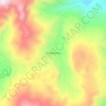
Name: Chontapampa topographic map, elevation, terrain.
Location: Chontapampa, Milpuc, Rodríguez de Mendoza, Amazonas, Perú (-6.51456 -77.43153 -6.47456 -77.39153)
Average elevation: 5,873 ft
Minimum elevation: 4,613 ft
Maximum elevation: 7,024 ft
Thank you for supporting this site ❤️
Make a donation
Make a donation
Gear up for your next adventure:
As an Amazon Associate, this site earns from qualifying purchases at no extra cost to you.