Geolocate

Plummer topographic map

Click on the map to display elevation.

About this map

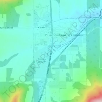
Name: Plummer topographic map, elevation, terrain.

Location: Plummer, Benewah County, Idaho, 83851, United States (47.31733 -116.89544 47.34449 -116.87461)

Average elevation: 2,802 ft

Minimum elevation: 2,638 ft

Maximum elevation: 3,517 ft

Benewah County trails, hiking, mountain biking, running and outdoor activities

Other topographic maps

Click on a map to view its topography, its elevation and its terrain.

Fernwood

United States > Idaho > Benewah County

Average elevation: 2,894 ft

Benewah

United States > Idaho > Benewah County

Average elevation: 3,035 ft

De Smet

United States > Idaho > Benewah County

U.S. Route 95 passes nearby and the community is located about a mile (1.6 km) south of Tensed, which was originally also to be titled Desmet before the name was ordered to be reversed and was subsequently misspelled by the post office. Latah Creek flows between the two communities. De Smet has a post office…

Average elevation: 2,605 ft

Gear up for your next adventure:

📻Weather Alert Radios - Stay informed of storm risks while off-the-grid
🦶Carbon Trekking Poles - Reduce knee impact on steep descents with ultra-light poles
🪄Magnetic Compass - Accurate compass for navigation
Solar GPS Watches - Advanced multisport watches with built-in topographic maps
🗺️Topographic Maps - Detailed topo maps for hiking, exploring and outdoor navigation

As an Amazon Associate, this site earns from qualifying purchases at no extra cost to you.