
Thank you for supporting this site ❤️
Make a donation
Make a donation
Gear up for your next adventure:
As an Amazon Associate, this site earns from qualifying purchases at no extra cost to you.
Ocoña topographic map
Click on the map to display elevation.
Thank you for supporting this site ❤️
Make a donation
Make a donation
Gear up for your next adventure:
As an Amazon Associate, this site earns from qualifying purchases at no extra cost to you.
About this map
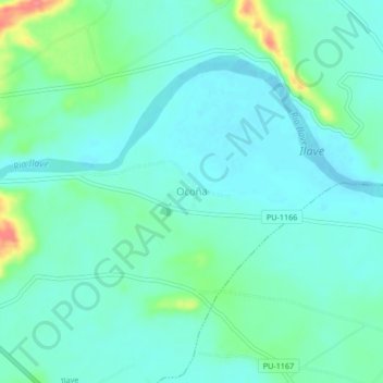
Name: Ocoña topographic map, elevation, terrain.
Location: Ocoña, Ilave, El Collao, Puno, Perú (-16.10726 -69.60848 -16.06726 -69.56848)
Average elevation: 12,579 ft
Minimum elevation: 12,526 ft
Maximum elevation: 12,759 ft
Thank you for supporting this site ❤️
Make a donation
Make a donation
Gear up for your next adventure:
As an Amazon Associate, this site earns from qualifying purchases at no extra cost to you.