Geolocate

Harmon topographic map

Click on the map to display elevation.

About this map

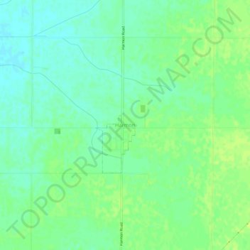
Name: Harmon topographic map, elevation, terrain.

Location: Harmon, Harmon Township, Lee County, Illinois, United States (41.70281 -89.57399 41.74281 -89.53399)

Average elevation: 679 ft

Minimum elevation: 653 ft

Maximum elevation: 699 ft

Lee County trails, hiking, mountain biking, running and outdoor activities

Other topographic maps

Click on a map to view its topography, its elevation and its terrain.

Amboy

United States > Illinois > Lee County

Average elevation: 784 ft

Franklin Grove

United States > Illinois > Lee County

Average elevation: 807 ft

Ashton

United States > Illinois > Lee County

Average elevation: 820 ft

Nelson

United States > Illinois > Lee County

Average elevation: 653 ft

West Brooklyn

United States > Illinois > Lee County

Average elevation: 945 ft

Steward

United States > Illinois > Lee County

Average elevation: 830 ft

Compton

United States > Illinois > Lee County

Average elevation: 958 ft

Paw Paw

United States > Illinois > Lee County

Average elevation: 928 ft

Sublette

United States > Illinois > Lee County

Average elevation: 909 ft

Gear up for your next adventure:

🍳Camping Cook Set - Complete cookware for outdoor meals
🪶Paracord Bracelet - Survival bracelet with built‑in tools
❄️Traction Cleats - Prevent slips on icy trails during winter hikes
🎒Outdoor Daypacks - Lightweight backpacks designed for carrying maps and essential gear
📡GPS Antenna Upgrade - Enhance GPS reception in remote terrain

As an Amazon Associate, this site earns from qualifying purchases at no extra cost to you.