Geolocate

Sibi topographic map

Click on the map to display elevation.

About this map

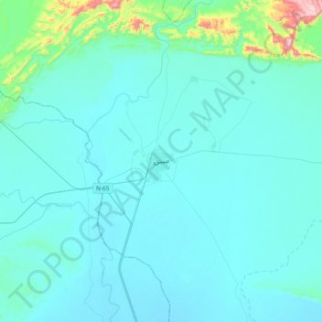
Name: Sibi topographic map, elevation, terrain.

Location: Sibi, Sibi Tehsil, Sibi District, Balochistan, 82000, Pakistan (29.39001 67.72334 29.71001 68.04334)

Average elevation: 558 ft

Minimum elevation: 387 ft

Maximum elevation: 2,431 ft

Gear up for your next adventure:

🕶️GPS Smartphone Mount - Secure mount for phone navigation
📡GPS Antenna Upgrade - Enhance GPS reception in remote terrain
🪶Survival Guide Book - Expert advice for emergency preparedness
⛑️Personal Locator Beacon - Safety beacon for emergencies
🏔️Mountain Trail Maps - High‑detail maps for popular peaks

As an Amazon Associate, this site earns from qualifying purchases at no extra cost to you.