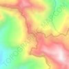
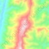
Serchhip topographic map
Click on the map to display elevation.
Serchhip
With an average elevation of 888 metres (2,913 ft), the average annual daily temperature ranges from 15 °C to 27 °C and the rainfall is moderate.
About this map

Name: Serchhip topographic map, elevation, terrain.
Location: Serchhip, Mizoram, India (23.01139 92.68275 23.59990 93.18036)
Average elevation: 2,408 ft
Minimum elevation: 210 ft
Maximum elevation: 6,115 ft
Other topographic maps
Click on a map to view its topography, its elevation and its terrain.
Aizawl
Aizawl has a mild, sub-tropical climate due to its location and elevation. Under the Köppen climate classification, Aizawl features a humid subtropical climate (Cwa). In summer, temperatures are moderately warm, averaging around 20–30 °C (68–86 °F). In winter, daytime temperatures are cooler in…
Average elevation: 1,824 ft




Aizawl
Aizawl (English: /ˈaɪzɔːl/ EYE-zawl; Mizo: [ˈaɪ̯.ˈzɔːl] ), formerly known as Aijal, is the capital city and the most populous city of Mizoram, India. It is also the third largest city in northeast India. It is situated atop a series of ridges, with an average elevation of around 1,132 metres (3,714…
Average elevation: 1,844 ft
Aizawl
Aizawl (English: /ˈaɪzɔːl/ EYE-zawl; Mizo: [ˈaɪ̯.ˈzɔːl] ), formerly known as Aijal, is the capital city and the most populous city of Mizoram, India. It is also the third largest city in northeast India. It is situated atop a series of ridges, with an average elevation of around 1,132 metres (3,714…
Average elevation: 1,844 ft
Aizawl
Aizawl (English: /aɪˈzɔːl/; Mizo: [ˈaɪ̯.ˈzɔːl] ), formerly known as Aijal, is the capital city and the most populous city of Mizoram, India. It is also the third largest city in northeast India, after Guwahati and Agartala. It is situated atop a series of ridges, with an average elevation of around…
Average elevation: 1,844 ft