
Thank you for supporting this site ❤️
Make a donation
Make a donation
Gear up for your next adventure:
As an Amazon Associate, this site earns from qualifying purchases at no extra cost to you.
Materuni topographic map
Click on the map to display elevation.
Thank you for supporting this site ❤️
Make a donation
Make a donation
Gear up for your next adventure:
As an Amazon Associate, this site earns from qualifying purchases at no extra cost to you.
About this map
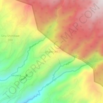
Name: Materuni topographic map, elevation, terrain.
Location: Materuni, Moshi Rural, Kilimangiaro, Northern Zone, Tanzania (-3.27510 37.38303 -3.23510 37.42303)
Average elevation: 5,545 ft
Minimum elevation: 3,976 ft
Maximum elevation: 7,044 ft
Thank you for supporting this site ❤️
Make a donation
Make a donation
Gear up for your next adventure:
As an Amazon Associate, this site earns from qualifying purchases at no extra cost to you.