
Nierstein topographic map
Interactive map
Click on the map to display elevation.
About this map
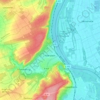
Name: Nierstein topographic map, elevation, terrain.
Average elevation: 407 ft
Minimum elevation: 266 ft
Maximum elevation: 682 ft
Other topographic maps
Click on a map to view its topography, its elevation and its terrain.
Ingelheim am Rhein
Germany > Rhineland-Palatinate > Landkreis Mainz-Bingen
Ingelheim am Rhein, Landkreis Mainz-Bingen, Rhineland-Palatinate, Germany
Average elevation: 515 ft
Budenheim
Germany > Rhineland-Palatinate > Landkreis Mainz-Bingen
Budenheim, Landkreis Mainz-Bingen, Rhineland-Palatinate, 55257, Germany
Average elevation: 371 ft
Oppenheim
Germany > Rhineland-Palatinate > Landkreis Mainz-Bingen
Oppenheim, Rhein-Selz, Landkreis Mainz-Bingen, Rhineland-Palatinate, 55276, Germany
Average elevation: 397 ft