
Lac Ray topographic map
Interactive map
Click on the map to display elevation.
About this map
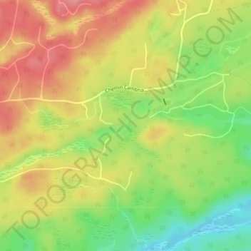
Name: Lac Ray topographic map, elevation, terrain.
Average elevation: 853 ft
Minimum elevation: 689 ft
Maximum elevation: 991 ft
Other topographic maps
Click on a map to view its topography, its elevation and its terrain.
Lac Williams
Lac Williams, Rue du Ruisseau William, Gore, Argenteuil, Laurentides, Quebec, Canada
Average elevation: 764 ft
Lac Chevreuil
Lac Chevreuil, Chemin du Lac-Chevreuil, Gore, Argenteuil, Laurentides, Quebec, Canada
Average elevation: 656 ft