Geolocate

Challuabamba topographic map

Click on the map to display elevation.

About this map

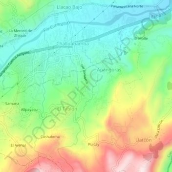
Name: Challuabamba topographic map, elevation, terrain.

Location: Challuabamba, Cuenca, Azuay, 010158, Ecuador (-2.88321 -78.92720 -2.84321 -78.88720)

Average elevation: 8,199 ft

Minimum elevation: 7,635 ft

Maximum elevation: 9,170 ft

Gear up for your next adventure:

🔭Telescopic Hiking Pole - Adjustable pole for hiking stability
🌎3D Topographic Globes - Raised relief globes for a tactile understanding of geography
🩳Quick‑Dry Hiking Shorts - Comfortable and quick‑dry shorts for summer hiking
🥾Hiking Shoes - Durable and comfortable shoes for trail hiking
🏔️Mountain Trail Maps - High‑detail maps for popular peaks

As an Amazon Associate, this site earns from qualifying purchases at no extra cost to you.