
Ciudad topographic map
Interactive map
Click on the map to display elevation.
About this map
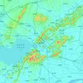
Name: Ciudad topographic map, elevation, terrain.
Location: Ciudad, Anhui, 238000, China (31.27051 117.42109 32.00165 117.96878)
Average elevation: 108 ft
Minimum elevation: -7 ft
Maximum elevation: 1,627 ft
Other topographic maps
Click on a map to view its topography, its elevation and its terrain.