Geolocate

Condorarma topographic map

Click on the map to display elevation.

About this map

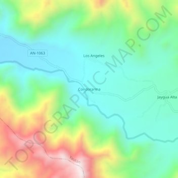
Name: Condorarma topographic map, elevation, terrain.

Location: Condorarma, Yaután, Casma, Áncash, Perú (-9.54914 -78.10943 -9.50914 -78.06943)

Average elevation: 1,850 ft

Minimum elevation: 1,001 ft

Maximum elevation: 3,694 ft

Other topographic maps

Click on a map to view its topography, its elevation and its terrain.

Río Casma

Perú > Áncash > Yaután

Average elevation: 5,016 ft

Gear up for your next adventure:

🥤Water Filter Bottle - All‑in‑one filter bottle for safe hydration
🎒Hydration Pack - Hands‑free water reservoir for long hikes
🎒Waterproof Dry Bags - Keep your electronics and maps dry inside your pack
🌲Outdoor Survival Books - Best books on survival skills
🪄Magnetic Compass - Accurate compass for navigation

As an Amazon Associate, this site earns from qualifying purchases at no extra cost to you.